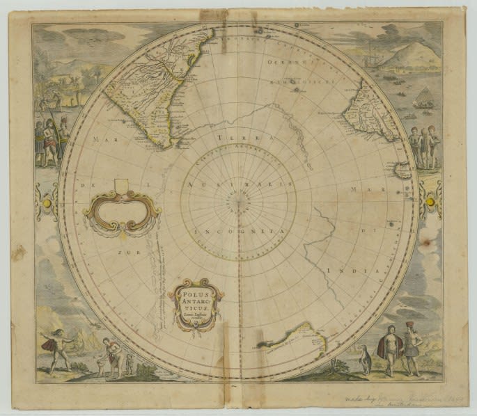
One of the oldest items in our Cartographic holdings is the Polus Antarcticus atlas page. Published in the 1630s by Henricus Hondius, a Dutch cartographer and engraver, the map is one of the first to depict the South Pole area.